
GMADA Sector Map Mohali — Sectors 61 to 123 Guide
Royals Property Consultant is a trusted name for buying, selling, renting, and investing in residential and commercial properties in Zirakpur, Mohali, Chandigarh, and New Chandigarh.
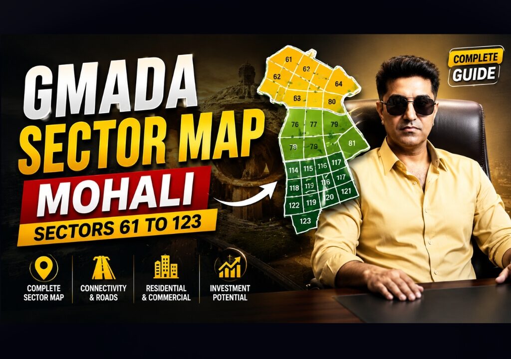
GMADA Sector Map Mohali — Sectors 61 to 123 Guide
How GMADA’s sector numbering actually works, how zoning and road hierarchy apply within a sector, and an honest, verified index of Sectors 61 through 123 — built from official GMADA notices rather than invented distances and details.
GMADA’s sectors are numbered continuing from Chandigarh’s original sector grid (which runs roughly up to the low 60s), so Mohali/S.A.S Nagar’s GMADA sectors begin at 61 and extend through the 100s as newer townships (Aerocity, Eco City, New Chandigarh-adjacent zones) were added. Each sector’s specific zoning — residential, commercial, institutional, industrial — is set by GMADA’s Zoning/Layout Plans, which GMADA is still digitising “in a phased manner” per its own website; there is no single, complete public directory covering every sector’s exact land use, road width, and distances. This guide gives you the real framework plus every sector-specific fact we could independently verify.
- What Is a GMADA Sector?
- Sector Numbering — Why It Starts at 61
- Road Network & Hierarchy
- Land Use Within a Sector
- Sector Index — 61 to 123
- Special Projects & Which Sectors They’re Near
- Investment Categories
- Legal Information
- Buyer Verification Guide
- Common Mistakes
- 40 Frequently Asked Questions
- Official References
Section 01What Is a GMADA Sector?
A “sector” is GMADA’s basic numbered planning unit — a defined, gridded parcel of the city assigned a specific land use under the master plan, similar in concept to Chandigarh’s original sector system. It’s distinct from a few related terms buyers often confuse:
- Sector — A numbered, boundaried planning unit with its own zoning
- Phase — An informal/colloquial name sometimes used for specific sectors (e.g., Sector 61 is commonly called “Phase 7” locally) — not an official GMADA planning category on its own
- Urban Estate — A broader developed township area, which may contain multiple sectors
- Planning Area / Local Planning Area (LPA) — The larger administrative planning zone (e.g., S.A.S Nagar LPA, Kharar LPA) within which multiple sectors sit
- Township — A GMADA-developed self-contained development (e.g., New Chandigarh/Mullanpur, Aerocity) which may use its own naming alongside or instead of sequential sector numbers
Section 02Sector Numbering — Why It Starts at 61
Mohali (S.A.S Nagar) was originally developed as a planned extension of Chandigarh, and its sector numbering continues sequentially from where Chandigarh’s own sector grid ends — Chandigarh’s sectors run roughly through the low 60s, so GMADA’s Mohali sectors begin at 61. As GMADA’s jurisdiction and townships expanded over the following decades — new residential belts, Aerocity, Eco City, and New Chandigarh-adjacent development — sector numbers extended well past 100. This is a historical/administrative continuity rather than a strict chronological development order — a higher sector number does not automatically mean newer or less developed; some higher-numbered sectors (like the 100s tied to Aerocity and Eco City) are among GMADA’s most actively marketed zones.
Section 03Road Network & Hierarchy
The same road hierarchy applies across every GMADA sector, per official Local Planning Area drawings:
| Road Type | Typical Width |
|---|---|
| GMADA Expressway / PR-numbered regional roads (e.g., PR7) | Widest tier — regional connector, exact width varies by stretch |
| Major Arterial Road | 60 metres |
| Minor Arterial Road | 48 metres |
| Collector Road | 39–45 metres, depending on the Local Planning Area |
| Primary/Sector Access Road | 30 metres, with secondary tiers around 18.5–24.5 metres |
PR7 specifically is GMADA’s own regional road designation running through the Aerocity/Aerotropolis corridor — distinct from National Highway or State Highway numbering. For the full corridor detail, see our dedicated Aerotropolis Expansion Map.
Section 04Land Use Within a Sector
Within any given sector, land is further zoned by GMADA’s Zoning Plan into specific uses — the same category framework used across GMADA’s Local Planning Area master plans:
Residential (R1–R6)
Graded density zones — most sector interiors
Commercial / Mixed Use
Typically along sector-dividing roads and major arterials
Institutional
Schools, hospitals, government buildings — specific reserved plots
Industrial
Confined to specific designated sectors (e.g., 101, 103 per official acquisition notices)
Green Space / Utilities
Parks, drainage, and utility reservations within the sector layout
Section 05Sector Index — 61 to 123
The table below covers every sector from 61 to 123. Where we found a specific, citable official notice or reliably documented fact tied to that exact sector, it’s noted. Where we did not, we say so plainly rather than guessing — treat those as “confirm directly with GMADA” rather than an information gap on our part.
| Sector | What We Verified |
|---|---|
| 51 | Site of the Chandigarh Horse Rider Club; GMADA issued a public works notice (chain-link fencing) here |
| 60 | Subject of a specific official GMADA public plot notice (Plot No. 1485) |
| 61 | Commonly known locally as “Phase 7”; residential sector bordering Sectors 62, 70 and 71 |
| 62 | Home to PUDA Bhawan — GMADA and PUDA’s own headquarters building |
| 63–66 | No independently verified sector-specific official notice found — confirm zoning directly with GMADA |
| 67 | Subject of an official GMADA works notice for a Community Centre and RCC Bridge construction |
| 68–69 | No independently verified sector-specific official notice found — confirm zoning directly with GMADA |
| 70 | Bordering Sector 61; established residential sector per GMADA/Chandigarh-adjacent records |
| 71 | Bordering Sector 61; established residential sector |
| 72–79 | No independently verified sector-specific official notice found — confirm zoning directly with GMADA |
| 80 | Subject of an official GMADA land acquisition notice concerning Village Molibaidwan |
| 81–86 | No independently verified sector-specific official notice found — confirm zoning directly with GMADA |
| 87 | Subject of an official GMADA notice — acquisition of land for setting up Commercial Infrastructure |
| 88–91 | No independently verified sector-specific official notice found — confirm zoning directly with GMADA |
| 92 / 92-Alfa | Subject of an official GMADA notification for acquiring ~14.75 acres for a sector-dividing road and sewer disposal works |
| 93–100 | No independently verified sector-specific official notice found — confirm zoning directly with GMADA |
| 101 | Subject of an official GMADA notice — acquisition of land for setting up an Industrial Park |
| 102 | No independently verified sector-specific official notice found — confirm zoning directly with GMADA |
| 103 | Subject of an official GMADA notice — acquisition of land for setting up an Industrial Park |
| 104–113 | No independently verified sector-specific official notice found — confirm zoning directly with GMADA |
| 114 | Site of “White City,” a specific affordable residential plotted colony (Village Kailon) with a revised layout plan on GMADA’s official notice board |
| 115–123 | No independently verified sector-specific official notice found — several of these numbers fall within GMADA’s newer Aerocity/Eco City-adjacent development belt per general area coverage; confirm exact sector zoning directly with GMADA |
Section 06Special Projects & Which Sectors They’re Near
For project-specific sector mapping (which exact sectors sit within Aerocity, Aerotropolis, or Eco City boundaries), our dedicated guides linked above go deeper than a general sector index can — they’re built specifically around those project boundaries rather than the full 61–123 numbering range.
Section 07Investment Categories
| Category | General Read |
|---|---|
| Best for End Users | Established residential sectors with existing infrastructure and social amenities already operational |
| Best for Rental | Sectors near IT/institutional employment clusters and established connectivity |
| Best for Commercial | Sectors along major arterial roads and PR7-adjacent corridors |
| Best for Long-Term/Emerging | Newer sector numbers tied to Aerocity, Aerotropolis and Eco City as infrastructure moves from planned to under-construction |
| Industrial Opportunity | Sectors specifically designated for Industrial Parks per official acquisition notices (e.g., 101, 103) |
Section 08Legal Information
- GMADA Approvals — Building plans and colony licences are approved against the sector’s Zoning Plan and Layout Plan
- FAR — Floor Area Ratio is set per zone/category within the sector, not uniformly across the whole sector
- Road Widening — Always check whether your plot’s frontage falls inside a planned road-widening reserve before assuming current frontage is permanent
- Green Belts — Protected, non-buildable, but adjacency can carry a resale premium
- CLU Implications — Agricultural pockets within or adjoining a sector require a formal Change of Land Use before non-agricultural construction
- Registry & Mutation — Registration transfers legal title; mutation separately updates revenue records — both are required, not just one
- Collector Rates — Vary by sector; Mohali’s rates were revised upward in October 2025 (residential +20-22%, industrial +30%, per public reporting) — confirm current rates before transacting
- PAPRA — Punjab Apartment and Property Regulation Act governs colony licensing and promoter obligations alongside RERA
- Punjab RERA — Any project selling under-construction units must be RERA-registered; verify on rera-punjab.gov.in before booking
Section 09Buyer Verification Guide
- Confirm the exact sector and plot number against GMADA’s current Zoning Plan for that sector
- Check the plot’s specific land-use category — don’t assume based on neighbouring plots
- Verify road width along your plot’s frontage against the road hierarchy table above
- Confirm ownership via Fard Jamabandi and check for encumbrances
- Cross-check the Master Plan designation for the broader area, not just the sector layout
- Ask specifically about any pending road-widening or land-acquisition notices affecting the sector
- Confirm the colony/layout carries a valid GMADA licence number if it’s a private colony within or adjoining the sector
Section 10Common Mistakes
❌ Trusting a Broker’s Verbal Sector Description
Always ask for the actual GMADA Zoning Plan reference, not just a verbal summary.
❌ Ignoring Road Alignment
A road shown as “proposed” on the plan isn’t built yet — don’t assume connectivity that doesn’t exist.
❌ Ignoring Green Belt/Drainage Adjacency
Can restrict setbacks and construction near your specific plot boundary.
❌ Ignoring High-Tension Line Corridors
Restricts construction directly beneath/near HT lines — verify before buying.
❌ Assuming Sector Number Implies Development Stage
Higher numbers aren’t automatically newer or less developed — check actual ground status.
❌ Skipping Government Acquisition Checks
Some sectors have active acquisition notices — always check before assuming stable ownership.
Section 11Frequently Asked Questions
Basics
Mohali’s sector numbering continues sequentially from Chandigarh’s own sector grid, which runs roughly through the low 60s — so Mohali/GMADA sectors begin at 61.
Sector is GMADA’s official numbered planning unit; Phase is often just a colloquial local name for a specific sector (e.g., Sector 61 is locally called Phase 7) and isn’t a separate official planning category.
A broader administrative planning zone — like S.A.S Nagar or Kharar — within which multiple numbered sectors sit, each with its own approved master plan.
No — GMADA’s own site states zoning plan digitisation is proceeding in a phased manner; there isn’t a single consolidated public directory with distances, schools, and hospitals for every sector.
Not necessarily — numbering reflects historical/administrative sequence, not a strict chronological or quality order; some higher-numbered sectors (Aerocity/Eco City-adjacent) are among GMADA’s most active zones.
Roads & Connectivity
60 metres, per GMADA’s official road hierarchy.
A GMADA-designated regional road running through the Aerocity/Aerotropolis corridor, distinct from National or State Highway numbering.
No — some remain proposed; always confirm construction status separately from planned status.
Typically 39 to 45 metres depending on the Local Planning Area.
Zoning & Land Use
No — a sector typically contains a mix of residential, commercial, and institutional plots side by side, defined by the detailed Zoning Plan, not a single blanket designation.
Sectors 101 and 103 are both subjects of official GMADA notices for Industrial Park land acquisition.
PUDA Bhawan, Sector 62, S.A.S Nagar.
An affordable residential plotted colony in Sector 114 (Village Kailon), with a revised layout plan publicly noticed by GMADA.
Yes, through formal amendments and Change of Land Use approvals — always check the current plan rather than an older reference.
Investment
Generally those near established employment clusters (IT/institutional) and existing connectivity — ask us for a current, specific-sector read rather than relying on a generic ranking.
They can carry more timing risk if infrastructure is still “planned” rather than “under construction” — but several (Aerocity/Eco City-adjacent) are already actively developing.
Proceed cautiously and verify exactly what’s being acquired and whether it affects your specific plot before committing.
No — proximity to confirmed infrastructure (PR7, Aerocity, Aerotropolis) has historically driven stronger appreciation than sectors without comparable catalysts.
Legal & Verification
Through GMADA’s Zoning/Layout Plans page, or by requesting the specific sector’s plan directly from GMADA’s office — digitisation is incomplete, so some sectors may require an in-person request.
Floor Area Ratio — the permitted construction ratio — is set per zone/category within a sector’s plan, not uniformly across an entire sector.
No — collector (circle) rates vary by sector and were revised upward in October 2025; always confirm the current rate for your specific sector.
The Punjab Apartment and Property Regulation Act, which governs colony licensing and promoter obligations alongside RERA.
Yes — registry transfers legal title, mutation separately updates revenue records; skipping mutation causes complications later.
Compare your plot’s frontage against the current Zoning Plan and road hierarchy for that sector — a widening reserve can reduce your usable frontage even if not yet built.
Yes — GMADA maintains and publishes lists of unauthorized colonies for exactly this kind of verification; cross-check before buying in any private colony within a sector.
Practical
Yes — send us the exact sector and, if known, plot number via WhatsApp and we’ll pull the current zoning status and any live GMADA notices before you commit.
Because GMADA doesn’t publish that level of per-sector detail officially, and we won’t invent specific names to fill a template — we’d rather tell you honestly and help you verify on request.
No — this is an independent reference guide summarising publicly available GMADA notices and planning principles; always confirm plot-specific detail directly with GMADA before transacting.
We update it as new official GMADA notices become available — last updated July 2026.
Section 12Official References
| Resource | Link |
|---|---|
| GMADA Zoning & Layout Plans (Official) | gmada.gov.in — Zoning & Layout Plans |
| GMADA Master Plans | gmada.gov.in — Master Plans |
| GMADA Development Plans | gmada.gov.in — Development Plans |
| PUDA Zoning Plans | puda.punjab.gov.in — Zoning Plans |
| PUDA Approved Master Plans | puda.punjab.gov.in — Approved Master Plans |
| Permission for Change of Land Use | gmada.gov.in — CLU Procedure |
| Punjab RERA | rera.punjab.gov.in |
“If a source gives you a specific school name or exact metro-distance for all 63 GMADA sectors, ask them where that came from — GMADA itself hasn’t published it. I’d rather tell you honestly what’s verified and pull the rest for you directly.”— Manindar Verma, Managing Director, Royals Property Consultant · RERA: PBRERA-CHD04-REA0390
Get a Specific Sector’s Zoning & Status Checked
Fill this in — it opens directly in WhatsApp, pre-filled and ready to send to Manindar Verma.
Get Your Sector's Real Status, Not a Guess
Free sector-specific verification against GMADA's current zoning and any live notices, from a RERA-verified consultant.