
GMADA Master Plan 2031 Land-Use Map — The Complete Guide
Royals Property Consultant is a trusted name for buying, selling, renting, and investing in residential and commercial properties in Zirakpur, Mohali, Chandigarh, and New Chandigarh.
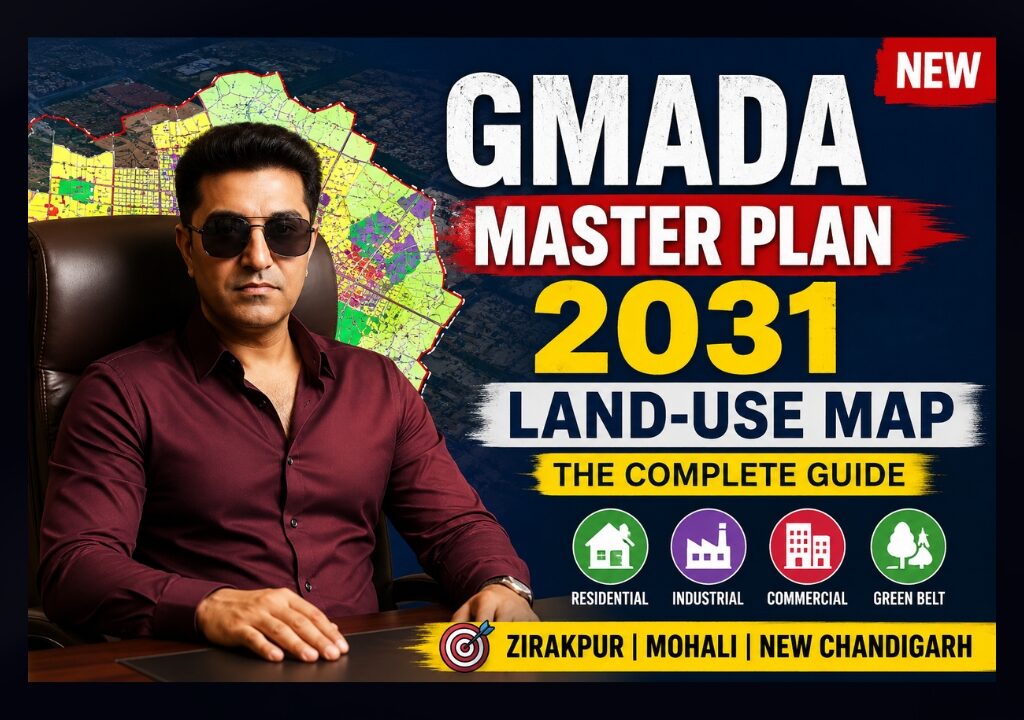
GMADA Master Plan 2031 Land-Use Map — The Complete Guide
Every colour on the official GMADA Master Plan 2031 land-use map means something legally binding — what you can build, where roads are coming, and which land is agricultural until formally rezoned. This guide decodes it, sourced directly from GMADA and PUDA’s own published master plan documents.
The GMADA Master Plan 2031 Land-Use Map is the official, legally referenced zoning document that shows what every parcel of land within GMADA’s jurisdiction — Mohali (S.A.S Nagar), Kharar, Banur, Zirakpur, Derabassi, and New Chandigarh (Mullanpur) — is designated for: Residential (graded R1–R6), Mixed Use, Industry & Warehouse, Institutional, Green Space, Water Bodies, Rural & Agriculture, or Transport. It was prepared for GMADA by Jurong Consultants under the Punjab Regional and Town Planning and Development Act, 1995, and each Local Planning Area (LPA) — Banur, Kharar, S.A.S Nagar, New Chandigarh — has its own separate approved master plan document rather than one single city-wide map.
- What Is a Land-Use Map?
- Master Plan 2031 — Overview
- Land Use Categories & Colour Legend
- Planning Areas Covered
- Road Network & Hierarchy
- How to Read the Map
- Investment Guide by Zone
- Legal Importance & CLU Process
- Master Plan vs Ground Reality
- Key Projects on the Map
- Common Buyer Mistakes
- 45 Frequently Asked Questions
- Official References & Bibliography
📲 Real estate mein aage rehna hai? Latest GMADA & property updates seedha apne WhatsApp par paayein — abhi join karein.
✅ Follow Our WhatsApp ChannelSection 01What Is a Land-Use Map?
A land-use map is the graphic, legally referenced part of a master plan that shows how every piece of land within a planning authority’s jurisdiction is designated to be used — residential, commercial, industrial, institutional, agricultural, or reserved for roads and green space. It is not a suggestion or a marketing brochure; it is the planning document that town planning officials, banks, architects, and courts refer back to when a dispute or approval question arises.
🏛 How Government Uses It
As the legal basis for approving or rejecting building plans, colony licences, and Change of Land Use applications.
💰 Why Investors Read It
To see which corridors are formally zoned for growth before prices reprice around an announcement.
🏗 Why Builders Study It
To confirm permitted density, road access, and use category before acquiring land for a project.
🏦 Why Banks Verify It
Loan approval on a plot depends on confirming it sits in an approved, correctly zoned layout — not an unauthorized colony.
📐 Why Architects Depend On It
Setbacks, FAR, and permitted building types trace directly back to the zone a plot falls under.
Section 02GMADA Master Plan 2031 — Overview
GMADA’s regional master plan was prepared with Jurong Consultants Pte Ltd (a Singapore-based planning firm) for the Greater Mohali region, under the Punjab Regional and Town Planning and Development Act, 1995. Rather than one single map covering the whole GMADA jurisdiction, GMADA has published separate approved master plans for each Local Planning Area (LPA) — Banur, Kharar, S.A.S Nagar (Mohali), and New Chandigarh (Mullanpur) each have their own plan report and land-use drawing, alongside a broader GMADA Regional Plan.
The plans set out proposed land use through the 2031 horizon — residential density grading, mixed-use corridors along major roads and waterways, industrial/warehouse pockets, institutional and health-care reservations, green space and water-body protection, and the road network needed to support projected population and economic growth. GMADA’s own Development Plans page specifically describes Mixed Use development being concentrated along rivers and major arterial roads, designed to be pedestrian-oriented with connected parks — a planning principle applied most explicitly in the New Chandigarh (Mullanpur) plan.
Section 03Land Use Categories & Colour Legend
The legend below is compiled directly from GMADA’s published Local Planning Area drawings (Banur and Kharar master plans specifically confirm these category codes). Exact colours can vary slightly in rendering between LPA documents, but the category codes and their meaning are consistent across GMADA’s plans.
| Category | Meaning | Investment Implication |
|---|---|---|
| Residential (R1–R6) | Graded residential density zones — R1 typically lowest density through to R6 higher density; exact density/FAR per grade is set in each LPA’s detailed regulations, not uniform across all LPAs | Core buyer/investor zone — confirm which R-grade applies before assuming plot size or FAR |
| Mixed Use | Combined residential + commercial + retail, concentrated along major arterial roads and rivers per GMADA’s stated planning principle | Historically strong appreciation — commercial-residential blend supports both rental and resale demand |
| Industry & Warehouse | Manufacturing, logistics, and warehousing designated pockets | Strong for logistics/industrial investors; not suitable for residential construction without a formal CLU |
| Educational Institution (E) | Land reserved for schools, colleges, and educational campuses | Anchors residential demand nearby; not directly buildable for private residential/commercial use |
| Health & Medical Care (H) | Land reserved for hospitals and medical facilities | Similar anchor effect to educational reservations |
| Green Space / Park | Protected open/recreational land — parks, green belts | Not buildable — but adjacency (Park Facing) commands a real premium on neighbouring residential plots |
| Water Body / River Reserve | Rivers, water bodies and their protected reserve margins | Not buildable; check flood-plain/reserve-margin rules before buying anything adjacent |
| Rural & Agriculture | Agricultural land under existing use — no construction permitted without a formal Change of Land Use (CLU) | Cheapest entry price, but highest legal risk — see Section 8 before buying |
| Existing Village (Abadi) | Existing village settlement areas, generally exempted from certain master-plan restrictions applicable to surrounding agricultural land | Village Abadi land has its own distinct legal treatment — verify with a local revenue/legal expert |
| Transport Facilities (T) / Road / Railway | Reserved road, rail, and transport-terminal corridors | Land inside a road-widening reserve cannot be built on — always check upcoming road alignments |
| Restricted / Buffer / Airport Influence Zone | Zones with development restrictions due to proximity to sensitive infrastructure (e.g., airport funnel/height-restriction zones) | Height and use restrictions apply regardless of the base residential/commercial designation — always cross-check airport zoning separately |
| Urbanisable Area | Land earmarked for future urban expansion beyond current development, released for development in phases | Longer-horizon, higher-risk/higher-reward — timing depends on GMADA’s phased release, not guaranteed |
Section 04Planning Areas Covered
| Planning Area | Status | Notes |
|---|---|---|
| S.A.S Nagar (Greater Mohali) | Approved LPA plan (2031 horizon) | Core Mohali sectors, Aerocity, IT City-adjacent zones |
| Kharar | Approved LPA plan (2031 horizon) | Classifies zones R1–R6, mixed use, institutional, agricultural per its own drawing |
| Banur | Approved LPA plan (2031 horizon) | Southern growth corridor toward Patiala Road |
| New Chandigarh (Mullanpur) | Separate development plan | Major arterial roads 60m, collector 45m, primary 30m; Mixed Use emphasized along MDR-B corridor |
| Zirakpur / Derabassi | Within GMADA’s broader jurisdiction | Fall under GMADA’s constituted jurisdiction per its 2006 notification; confirm current LPA-specific plan status directly with GMADA for these towns |
| Kurali | New/draft LPA plan reported (2026) | Previously covered only under the broader regional umbrella; GMADA reported preparing a dedicated Kurali LPA plan covering ~78 villages as of 2026 |
| Gharuan & ~16 surrounding villages | Proposed amendment (2026) | Industrial and commercial zoning amendment reported under consideration as of 2026 — not yet a finalised master plan |
Section 05Road Network & Hierarchy
GMADA’s LPA plans define a consistent road hierarchy by width, which directly determines how much land is reserved (and cannot be built on) along each corridor.
| Road Type | Typical Width |
|---|---|
| GMADA Expressway (e.g., PR1) | Widest tier — regional connector, exact width varies by stretch |
| Major Arterial Road | 60 metres |
| Minor Arterial Road | 48 metres |
| Collector Road | 39 metres (Kharar/Banur plans); 45 metres in New Chandigarh’s plan |
| Primary Access Road | 30 metres |
| Primary Access (secondary tier) | ~24.5 metres (80 ft) / ~18.5 metres (60 ft), per Kharar’s heritage-area detailing |
| Heritage Street | ~12 metres (40 ft) |
PR-numbered roads (like PR1, the GMADA Expressway referenced in Banur’s plan, and PR7 in the Aerocity/Aerotropolis corridor) are GMADA’s own regional road designations, distinct from National Highway (NH) and State Highway numbering. Always confirm a specific PR road’s current alignment and width against the live LPA drawing — some stretches remain proposed rather than built.
Section 06How to Read the Map — Beginner Guide
- Find your Local Planning Area first. GMADA publishes separate plans per LPA — confirm whether your plot falls under S.A.S Nagar, Kharar, Banur, or New Chandigarh before opening the wrong drawing.
- Locate the village or sector name printed on the drawing — village names anchor rural/agricultural parcels; sector numbers anchor developed GMADA townships.
- Match the colour/code to the legend printed on that specific sheet — don’t assume colours are identical across different LPA documents.
- Check road width along your plot’s frontage against the road hierarchy table above — this tells you if a road-widening reserve eats into your usable land.
- Look for green space, water body, or buffer zone adjacency — these affect both what you can build and how close you can build to the boundary.
- Note the drawing number and date printed on the sheet (e.g., “D.T.P (S.A.S) 2031/10, Dated 5.2.2010”) — this confirms which revision you’re looking at, since plans get amended.
Section 07Investment Guide by Zone
| Zone | Investment Read |
|---|---|
| Mixed Use, along major arterial roads | Generally the strongest combination of appreciation + rental demand — commercial frontage plus residential depth |
| Higher-grade Residential (confirm exact R-code) | Core end-user and investor demand; verify density/FAR before comparing plots across sectors |
| Industry & Warehouse | Strong for logistics-focused investors given e-commerce-driven warehousing demand; less relevant for residential end-users |
| Rural & Agriculture (no CLU yet) | Cheapest entry, highest legal risk — value is speculative on a future CLU that may take years or may not happen on your specific parcel |
| Near confirmed infrastructure (PR7, Aerocity, Aerotropolis corridors) | Historically GMADA’s fastest-appreciating pockets once infrastructure moves from “planned” to “under construction” |
| Airport Influence / Restricted Zones | Height and use restrictions apply regardless of underlying zoning — factor this into any high-rise or hospitality development plan |
Section 08Legal Importance & the CLU Process
Is the Master Plan legally binding? Yes — it’s prepared and approved under the Punjab Regional and Town Planning and Development Act, 1995, and forms the legal basis on which GMADA and the Department of Housing & Urban Development approve or reject building plans, colony licences, and land-use change applications.
Can land use change? Yes, through a formal Change of Land Use (CLU) application — but only after the zone is officially notified for that use. Per GMADA’s own published procedure, an agricultural landowner cannot legally build residential or commercial structures until CLU is granted.
CLU — Document Checklist (Per GMADA’s Official Procedure)
- Location map of the site showing nearby features and roads
- Copy of Shajra Plan showing the site, signed by the Patwari
- Proof of ownership — Fard Jamabandi (not older than two months)
- Copies of sale deeds
- Irrevocable consent from the landowner authorising the promoter to obtain CLU, if applicable
- Non-encumbrance certificate from the concerned Tehsildar/Sub-Registrar
Who approves CLU? Per Punjab Government notification, the Department of Housing & Urban Development is designated as the single agency for CLU grant to avoid multiple/conflicting rates and approvals across authorities. Processing typically takes weeks to a few months depending on documentation completeness and site inspection.
Section 09Master Plan vs Ground Reality
A master plan shows what’s approved or proposed — not what’s already built. Three categories matter when you’re evaluating a specific plot:
- Developed Sectors — Roads, utilities, and a functioning colony already exist on the ground
- Approved but Undeveloped — The zone is legally designated and licensed, but infrastructure hasn’t been built out yet
- Proposed / Future Sectors — Shown on the plan as future urbanisable area, but not yet formally released or infrastructure-committed
The gap between “on the map” and “on the ground” is exactly where both opportunity and risk concentrate — early entry into a genuinely approved-but-undeveloped zone can capture appreciation, while buying into a purely proposed/future zone on hope alone carries real timing risk.
Section 10Key Projects on the Map
For IT City, Knowledge City, and Medicity specifically, we recommend cross-checking the current sector-wise designation directly on GMADA’s Master Plans page, since institutional/technology-park zoning within these areas is periodically refined by amendment.
Section 11Common Buyer Mistakes
❌ Buying Without Checking Land Use
Assuming a plot is residential just because neighbours have built houses — verify the actual zone code.
❌ Ignoring Road Widening Reserves
A frontage that looks generous today may sit inside a future road-widening line.
❌ Ignoring Green Belt / Water Reserve Rules
Adjacent land often carries setback restrictions you won’t discover until you apply for a building plan.
❌ Skipping CLU Verification on Agricultural Land
“It’ll get CLU eventually” is a bet, not a fact — confirm current zoning status, not future hope.
❌ Buying in Unauthorized Colonies
GMADA maintains and publishes lists of unauthorized colonies — a licensed colony number is the only real proof of an approved layout.
❌ Ignoring Pending Land Acquisition Notices
GMADA periodically issues acquisition notices (e.g., Aerotropolis Extension, specific sectors) — check these before assuming stable ownership.
Section 12Frequently Asked Questions
Basics
It’s GMADA’s officially approved land-use planning document, prepared with Jurong Consultants under the Punjab Regional and Town Planning and Development Act, 1995, showing designated land use across Local Planning Areas through the 2031 horizon.
No — GMADA publishes separate approved master plans per Local Planning Area (Banur, Kharar, S.A.S Nagar, New Chandigarh), operating under one broader regional planning framework.
Jurong Consultants Pte Ltd, a Singapore-based urban planning firm, prepared the plan for GMADA.
On GMADA’s own Master Plans page (gmada.gov.in/en/information/master-plans) and PUDA’s Approved Master Plans page.
Yes — it’s the legal basis GMADA and the Housing & Urban Development Department use to approve or reject building plans, colony licences, and land-use change applications.
Land Use Categories
They represent graded residential density zones — generally R1 as lower density through R6 as higher density — with exact permitted density set in each LPA’s detailed regulations.
Land combining residential, commercial and retail use, typically concentrated along major arterial roads and rivers per GMADA’s planning principle.
No, not without a formal Change of Land Use (CLU) approval converting it to residential or the relevant permitted category first.
It denotes existing village settlement land, which carries its own distinct legal treatment separate from surrounding agricultural land — verify specifics with a local revenue expert.
Protected open/recreational land that cannot be built on, though adjacent residential plots often command a price premium for the view and access.
An area with development restrictions (typically height limits) due to proximity to airport operations, applied regardless of the underlying residential/commercial zoning.
Manufacturing, logistics and warehousing use — not residential construction without a separate CLU.
Land earmarked for future urban expansion beyond current development, released for development in phases at GMADA’s discretion — not a guaranteed near-term timeline.
Planning Areas
Zirakpur falls within GMADA’s broader constituted jurisdiction; confirm the current Local Planning Area-specific plan status for Zirakpur directly with GMADA, since this guide could not independently confirm a dedicated Zirakpur LPA drawing distinct from the regional plan.
Yes — Kharar has its own approved Local Planning Area master plan classifying zones R1 through R6, mixed use, institutional and agricultural categories.
Yes, New Chandigarh has its own development plan with specific road-width and mixed-use planning principles emphasized along its major arterial corridor.
Kurali was historically covered only under the broader regional umbrella; GMADA has reported preparing a dedicated Kurali Local Planning Area plan as of 2026 — confirm its current approval status before relying on it.
An industrial and commercial zoning amendment for Gharuan and roughly 16 surrounding villages was reported under consideration as of 2026 — this is a proposed amendment, not yet a finalised master plan.
Roads
60 metres, per the road hierarchy defined in GMADA’s Local Planning Area drawings.
48 metres.
Typically 39 metres in the Kharar/Banur plans, and 45 metres in New Chandigarh’s plan.
PR7 is one of GMADA’s own regionally designated roads (the “PR” prefix denotes GMADA’s road numbering, distinct from National/State Highway numbering), running through the Aerocity/Aerotropolis corridor.
No — some are existing, others remain proposed. Always confirm a specific stretch’s construction status separately from its planned status.
Reading the Map
Check the village or sector name against GMADA’s published Local Planning Area boundaries — Banur, Kharar, S.A.S Nagar, and New Chandigarh each have distinct coverage.
It identifies the specific revision of that plan sheet — since master plans get amended, always confirm you’re viewing the current approved revision.
Buffer/restricted zones are marked separately from base residential or commercial colours and typically apply near sensitive infrastructure like airports or utility corridors.
Yes — copies are available at GMADA’s headquarters, district town planner offices, relevant municipal offices, and on the PUDA/GMADA websites.
Investment
Mixed Use zones along major arterial roads and areas near confirmed infrastructure (like the Aerocity/Aerotropolis/PR7 corridor) have historically shown the strongest appreciation once infrastructure moves from planned to under-construction.
It’s the cheapest entry point but carries the highest legal risk, since its value depends on a future CLU that may take years or may never be granted for your specific parcel.
Confirmed infrastructure announcements in the Aerotropolis corridor have historically driven appreciation in adjacent zones — see our dedicated Aerotropolis expansion map guide for specifics.
These can offer strong returns for logistics-focused investors given e-commerce-driven warehousing demand, but are not usable for residential purposes without a separate CLU.
Height and use restrictions apply regardless of the base zoning colour, which can limit high-rise or certain hospitality developments — verify separately from general residential/commercial zoning.
Legal & CLU
Change of Land Use — the formal government permission required to legally convert land (typically agricultural) to residential, commercial, or industrial use.
The Department of Housing & Urban Development is designated as the single competent authority for CLU grant, to keep rates and approvals uniform across urban development authorities.
A location map, Shajra Plan signed by the Patwari, proof of ownership (Fard Jamabandi not older than two months), sale deed copies, owner consent where applicable, and a non-encumbrance certificate.
Typically a few weeks to a few months, depending on documentation completeness and site inspection — complex cases can take longer.
Only through a formal zoning amendment or CLU process approved by the competent authority — it does not happen automatically or informally.
Unauthorized construction on land without the correct land-use approval can face fines, litigation, and potential demolition.
Check for a valid GMADA colony licence number and registered layout plan — GMADA maintains and publishes lists of unauthorized colonies for exactly this verification purpose.
Practical
Banks typically verify that a plot sits in an approved, correctly zoned, licensed layout before sanctioning a loan against it.
Yes, master plans are amended periodically by official notification — this is exactly why ongoing verification (not just at purchase time) matters for long-term holdings.
A revenue department site plan showing a parcel’s boundaries, used as part of ownership/location verification, including in the CLU process.
GMADA is the specific development authority for the Greater Mohali region; PUDA (Punjab Urban Planning & Development Authority) operates at the broader state level and hosts shared resources like the approved master plans directory.
No — the master plan sets broad land-use zoning across a whole planning area; a sector layout plan is the detailed, plot-level subdivision within an already-zoned and licensed area.
Yes — GMADA’s process includes a hearing of objections stage (for example, on land acquisition notices) where affected landowners can formally raise objections before final approval.
GMADA publishes land acquisition and hearing-of-objections notices on its official website — check these regularly if you own land in an active growth corridor.
Yes — we cross-check GMADA’s published plans and current notices against a specific plot before you commit; reach out via WhatsApp with the sector/village details.
Section 13Official References & Bibliography
| Resource | Link |
|---|---|
| GMADA Master Plans (Official) | gmada.gov.in/en/information/master-plans |
| GMADA Approved Master Plans | gmada.gov.in/en/master-plans/approved-master-plans |
| S.A.S Nagar (2031) Plan Page | gmada.gov.in/en/sas-nagar-2031 |
| GMADA Development Plans (New Chandigarh detail) | gmada.gov.in/en/development-plans |
| Permission for Change of Land Use — Procedure | gmada.gov.in/en/permission-for-change-of-land-use |
| PUDA — Approved Master Plans | puda.punjab.gov.in — Approved Master Plans |
| PUDA — Apply for Change of Land Use | puda.punjab.gov.in — Apply for CLU |
This guide also draws on the publicly available Banur and Kharar Local Planning Area master plan drawings (hosted on puda.punjab.gov.in) for road-hierarchy and land-use legend details, referenced via search rather than direct reproduction, in line with copyright practice.
“The plan colour is a legal fact, not a marketing description. I’ve seen buyers pay a ‘residential’ price for land that was still agricultural on GMADA’s own map — always ask for the plot’s exact zone code before you negotiate price.”— Manindar Verma, Managing Director, Royals Property Consultant · RERA: PBRERA-CHD04-REA0390
Get Your Plot’s Exact Master Plan Zoning Checked
Fill this in — it opens directly in WhatsApp, pre-filled and ready to send to Manindar Verma.
Don't Guess a Plot's Zoning — Confirm It
Free zoning verification against GMADA's official master plan and current notices, from a RERA-verified consultant.